Wednesday, July 13, 2005

Speed Racer Kauai


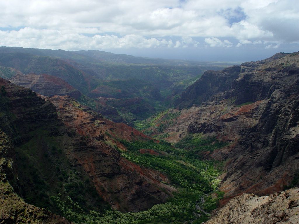
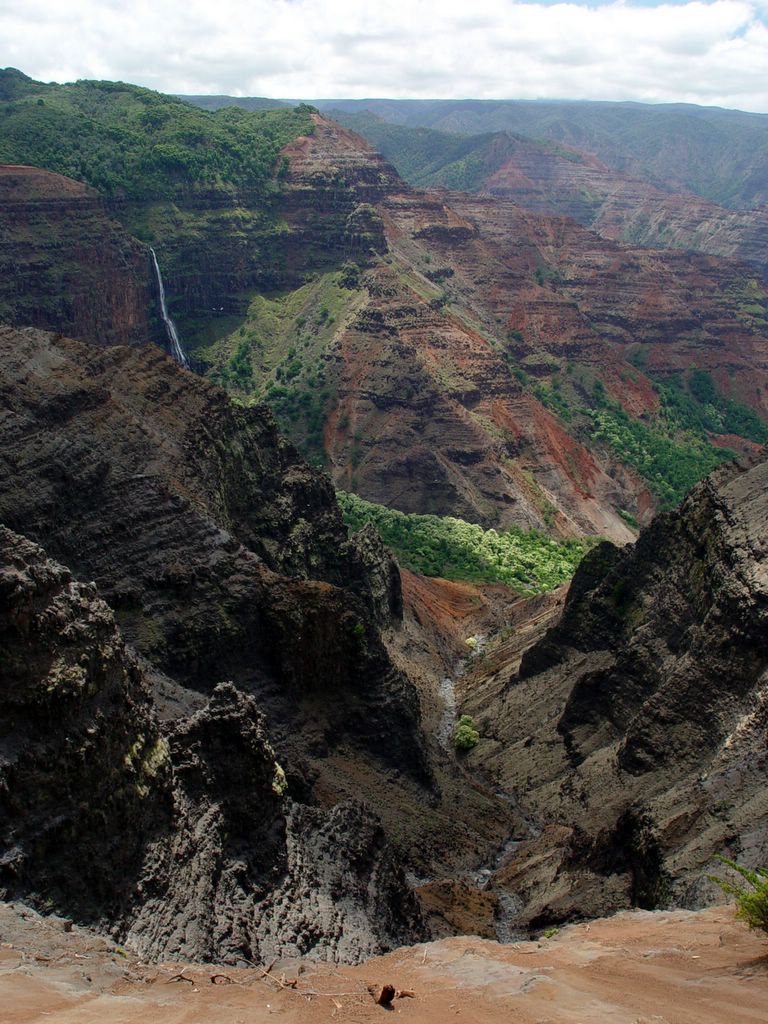
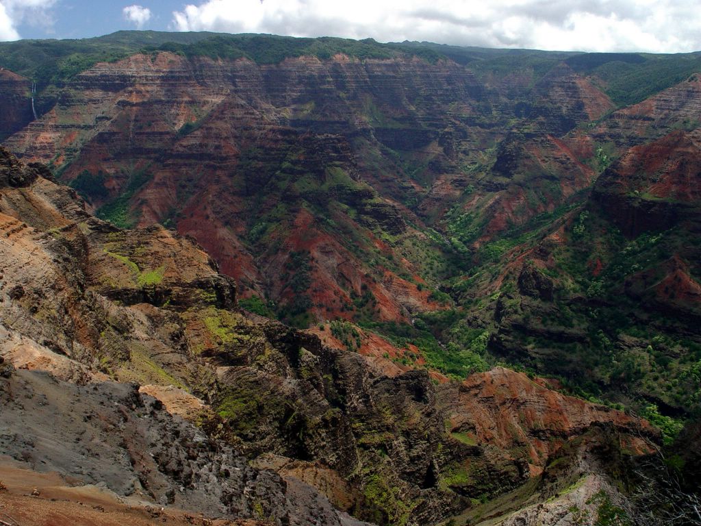
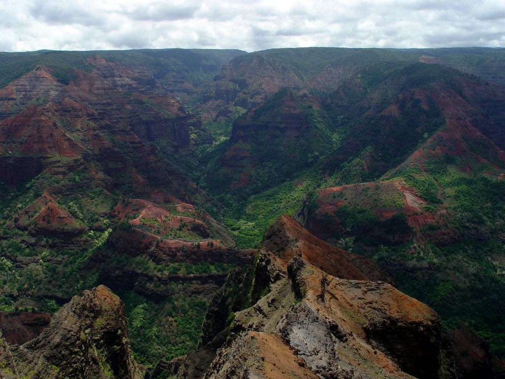
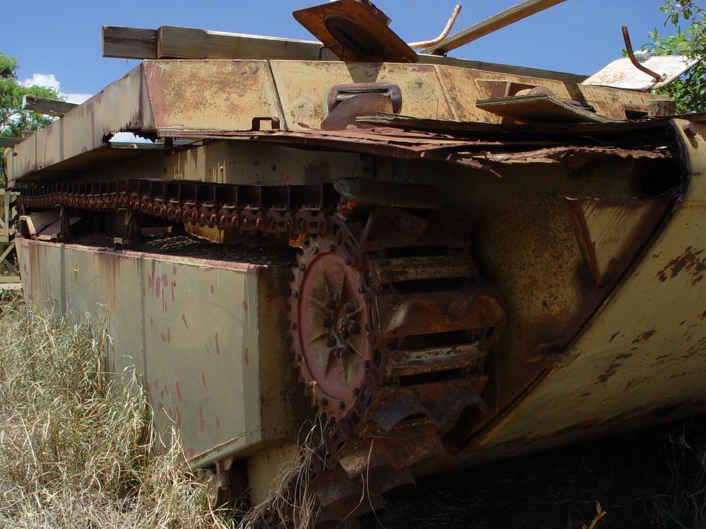
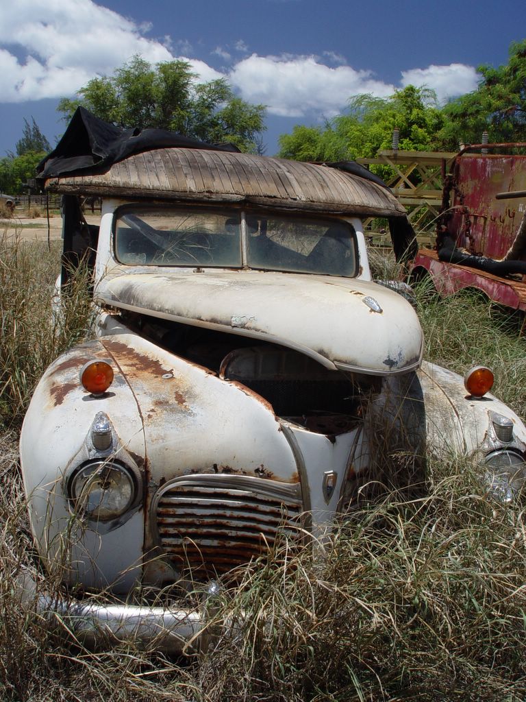
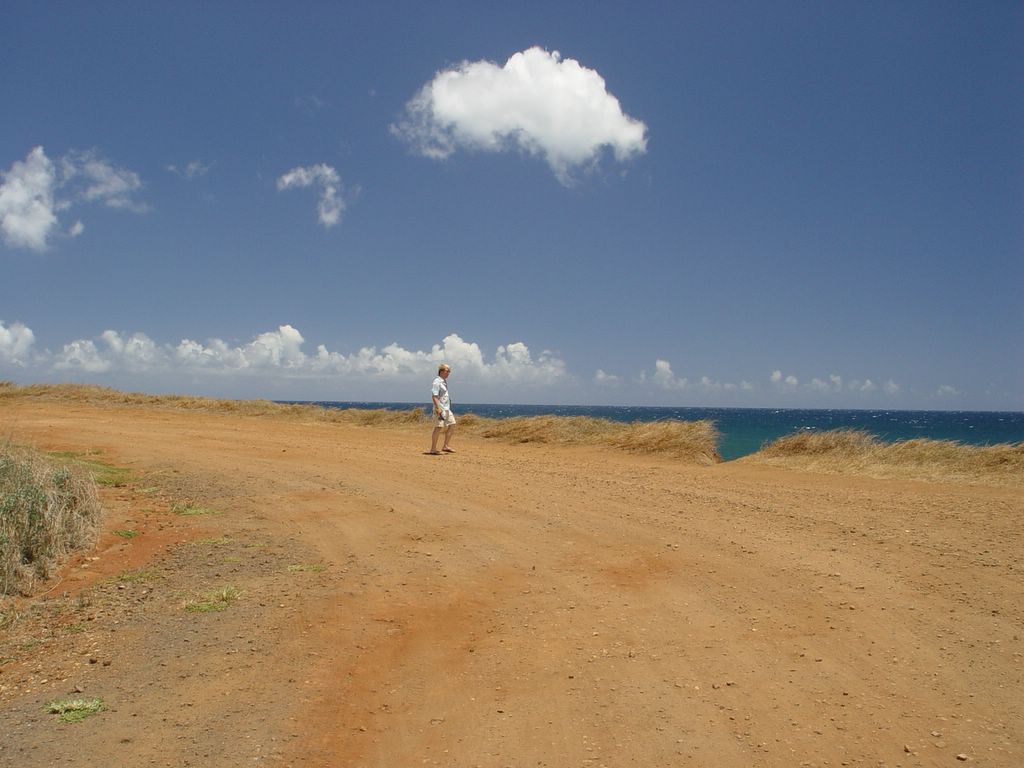
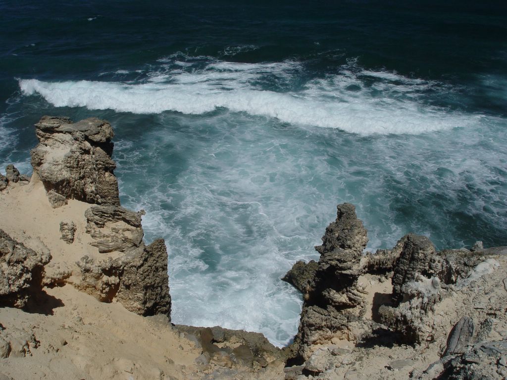
8:30 AM. It is Sunday and my friend Phil leaves on Monday. He arrived from Florida on Friday, 48 hours before. Yes, he flew a 18+ hour flight to come and see me for 72 hours. His combined flight to and home is almost as long as the time he spent here. We were supposed to kayak around the island but our guide flaked out on us at the last moment and canceled the trip. Thanks Melissa for nothing. I was so pissed because she was not even professional enough to tell us herself. I called her every day at the begining of the week to find out where we were to meet her and she never would return my call. I thought it was just bad timing, turns out she was avoiding us. I spent $30 on camping permits to Kalalau valley that are sitting in my glove box unused. Anyway, on Phil's last day we decided to be Speed Racer and see as much as the island as possible. [WARNING this is the largest single posting I have ever done - over 30 photos and my rambling text. Refill the coffee cup, or glass of wine or bourbon and get comfortable. Thanks for reading]Posted by Picasa

This is the official map of our "Speed Racer Day" Notice the red/yellow numbers from 1-11 on the map, these are in reference to the pictures below. We actually stopped at more places but I somehow forgot to take the pictures. On Friday, the day Phil arrived, we looked at some of the sites in the areas between Kapaa and Hanalei, so that is why the map is blank here. I will post those pictures later. Posted by Picasa

SITE 1.

10:19 AM. After renting the car in Lihue I raced us up Waimea canyon road to get to this Kalalau valley lookout before 10 am. After 10 am the clouds roll in from the sea and obscure the view. I was driving like a mad man as Phil would ooh and ahhh at the passing canyon scenes, ocean views, and mountain vistas. I told him that we would see all those things later, as we had a mission to get to the end of the road before the clouds do. As you can see, we made it in time and the view was spectacular. After taking bucket loads of photos, we climbed in the car and made a more leisurly trip down the canyon road. My goal today was to show Phil as much as the island as possible in the 9 hours of sunlight. Ultimately we would end up on the Na Pali trail to Kalalau valley, a spot somewhat directly below us but we must drive all around the island to get there. Posted by Picasa

SITE 2.
11:07 AM. Here is a picture of Phil, my friend since I was 12 years old and the best man at my wedding. Damn he looks white and touristy. Unfortunately the sun was hidden most of the time he was here so we could do little to help his melanin deficit. Posted by Picasa

Puu Hinahina lookout. As we drive down the canyon road we follow along the rightside of the canyon. Way down in the distance you can see the ocean. As we looked down into the valley we could see white longtailed tropic birds flying about as they were nesting in the cliff faces. If there is such a thing as reincarnation, it would be a pretty good gig to come back as a tropic bird flying around these beautiful canyons and eating fish and squid out in the ocean blue.  Posted by Picasa

11:19 AM. There are a couple of unofficial stops on the road as you drive along the canyon. This is one of my favorites since it gives a great view of this waterfall. We could barely hear it roar since cars would go speeding by us every 2 seconds.  Posted by Picasa

11:34 AM. If you look in the top left corner you can see the waterfall from the previous picture. The scale of this canyon is amazing, unless of course you have been to the Grand Canyon. Contrary to the urban legend, Mark Twain never came to Kauai nor called the Waimea "the Grand Canyon of the Pacific".  Posted by Picasa

11:40 AM. This is the major overlook to the Waimea canyon. I already have a slew of photos of this canyon and yet I found myself taking a new slew of pictures. We saw a goat below us. Posted by Picasa

SITE 3.
12:21 PM. When I was in college living with Phil he got me interested in photography. We used to go around and photograph strange buildings and junkyards around Tampa, FL. I forgot the joy of photographing the dregs of our civilization. Phil noted that the only thing missing from the gun was its breech. So close to mayhem and yet so far. Posted by Picasa

12:22 PM. The last thing I would expect to see during our day expedition was an army tank. That is the joy of traveling with Phil, he can always spot the unique elements of an area. I drove by this site half a dozen times and I never saw these rusting hulks, Phil's innate sense for rust is amazing. Posted by Picasa

12:26 PM. I loved this car. It was a 1940's Plymoth that was modified to a tour car. The entire back is a wrap around couch and it must have been a S W E E T ride. What I was most impressed with was the use of wood to create the new roof.  Posted by Picasa

SITE 4.
12:56 PM. The biggest crop along the south shore is sugar cane. You also see some corn and a few other crops (e.g. coffee) but most of the low level land here is covered in sugar cane. The only working sugar mill is a couple miles to the left of this picture. We came across this area that was just recently harvested. Looks like Mars to me. Posted by Picasa

SITE 5.
1:05 PM. We stopped in a very small town called Hanapepe. During the 1992 hurricane the bridge was destroyed so they replaced it with this swinging foot bridge. My camera was balanced on the rail of the bridge to take the self portrait. As I rushed into the picture frame before the shutter went off, the rail it rested on bounced with every step I took - it was not attached to the bridge and I nearly dropped my camera taking this picture. Phil warned me so I quickly stopped and posed. Posted by Picasa

SITE 6.
1:16 PM. When we first drove up to the area known as Glass beach Phil immediately noticed the cemetery on the hill. Phil is fascinated with rusting cars, decaying abandoned buildings, and cemeteries. With little imagination you can see the connection between these phenomenon. Anyway, like a moth to a flame Phil marched up the hill to explore this barren monument. It was as hot and arid as this picture appears. It was not the Kauai I was familiar with. Posted by Picasa

1:27 PM. I was totally enthralled by the style of many of the headstones in the cemetery. This may sound like I am stereotyping but the Japanese have such amazing sense of style. The rough shape of the stone, the beauty of the writing, the color of the aged stone all come together to make a memorable marker for a life we could never know. Posted by Picasa

1:28 PM. Phil walking from the Japanese cemetary to the sea. We later realized that we were walking on top of the old city dump, layers of our past compacted below our feet. We slid down the cut by the road side to see the debris below. Posted by Picasa

1:29 PM. This is the old dump eroding into the sea. Embedded into the soil you can see bits of metal, old bottles and other debris. Scattered below are larger objects. A piece of glass I found in the soil was opalescent and appeared to be at least 60 years old. This is the source of the material that eventually forms Glass beach. Posted by Picasa

1:34 PM We climbed down to the lava shelf that lies between the ocean and the layers of dirt and trash. Large metal objects are scattered about the lava shelf - old wheels, engine blocks, turbines, huge chunks of steel that have corroded beyond recognition. Although it is visually unappealing, if it is just iron rusting then this would be a minor impact on the environment. However, I saw batteries and other industrial objects which are also releasing lead, mercury, and other less benign metals and materials into the sea. Posted by Picasa

1:38 PM. Nestled between oil storage tanks for the power plant and the Japanese cemetary / old city dump lies Glass beach.  Posted by Picasa

1:43 PM. Phil scooped his hands into the surf and this is what he pulled up. It is mind numbing how much glass is on the beach here.  Posted by Picasa

1:48 PM. The sloping shore of glass beach. As I stood here taking this picture a guy on the cliff above me chucked his beer bottle into the sea. I guess he figured he was giving his contribution to the beach.  Posted by Picasa

1:50 PM Overview of glass beach and the Japanese cemetery. No matter how I think about it is seems like such a disrepectful thing to the Japanese cemetery - either they were forced 100 years ago to place their cemetery out here by the dump OR the cemetery was placed in a majestic overlook of the ocean that later was co-opted by the city as the site for an industrial park and city dump that came to grow around the cemetary like a cancer tumor.

Sad either way I look at it. Posted by Picasa

Site 7.
2:47 PM. We drove to the south shore near Shipwreck beach to look at the lithified sand dunes. This is a striking portion of shoreline in that the rocks are white instead of the typical black lava rocks near shore. Sand dunes from the last ice age have been cemented to form this very soft sandstone which then gets carved by the strong sea winds. Posted by Picasa

3:00 PM. More of the lithified sandstone and sea. Posted by Picasa

3:10 PM. This is a great example of how wind sculpted this area is. If you examine these bluffs up close you will see lace fine layers of sandstone. In another 5,000 years I can see all of this eroded away to fine sand. Posted by Picasa

Free Website Counter
Online Degrees