Friday, February 11, 2005


View of the ridge top vegetation. Notice the complex root structure of this Hala tree (Pandanus tectorius). It is an adaptation to help stabilize a tree that is has easy access to water (so it grows only shallow roots) but is exposured to high winds.Posted by Hello

Okolehao Trail


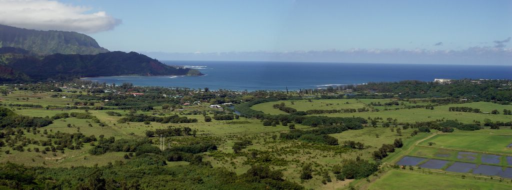
I hiked up Okolehao trail yesterday. This trail starts at about sea level at the Wildlife Refuge Center, which is the taro field wetlands by the Hanalei bridge. From there you follow a trail that quickly goes up a small mountain ridge that defines the western side of the Hanaeli river valley. As you hike up the trail you are initially in a deep corridor of vegetation and little can be seen except beautiful red dirt, ferns and weeds. However, about 15 minutes into the hike when you have gained a little elevation the breaks in the vegetation reveal this wonderful view of Hanalei Bay.

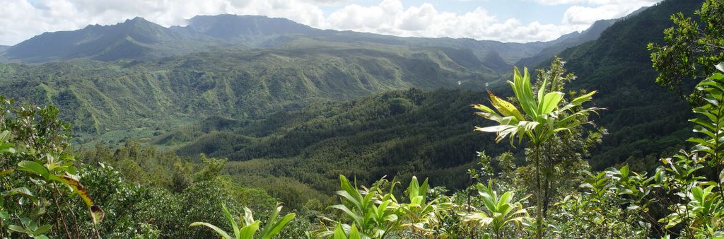
Have you ever looked at a mountain range and thought it would be cool to hike along the top edge of the mountains? Balanced as if walking along the edge of a knife? That is what this hike is like, as it goes up to the lowest of the peaks - Kaukaopua - into the Hanalei Forest Reserve. It is a 2.25 mile long hike to the top (4.5 round trip) that is fairly easy to do. Posted by Hello


When I tell people I am here to research spiders, most people say "Yeah, I've seen that spider" when, more often than not, they are actually talking about this crab looking spider. This spider is Gasteracantha cancriformis, an introduced species from the mainland. Obviously not D. raptor. Posted by Hello


This is the southern view from the end of the Okolehao trail at the top of Kaukaopua (alt. 413 m). You are looking into the Hanaeli river valley. A glint of the river is visible at the top right center of the picture.

The ridge top across the valley is where the Powerline Trail follows south to Kapa'a. Posted by Hello


This is a panaramic view of the beautiful Hanalei bay. Taro fields are in the foreground bottom right. The winding Hanalei river is indicated by the dark green tree line that is in the center right of the picture. This picture was taken at an altitude of 383 m.

It was a calm day on the ocean and from this vantage point I could see whales splashing off in the distance, just out from Puu Poa point (which is by the White clump of buildings on right edge of Hanalei Bay). [REMEMBER - You can click on any of these pictures to enlarge them for better viewing.] Posted by Hello

Free Website Counter
Online Degrees